Committed to delivering the best value to your organization

Practice Areas

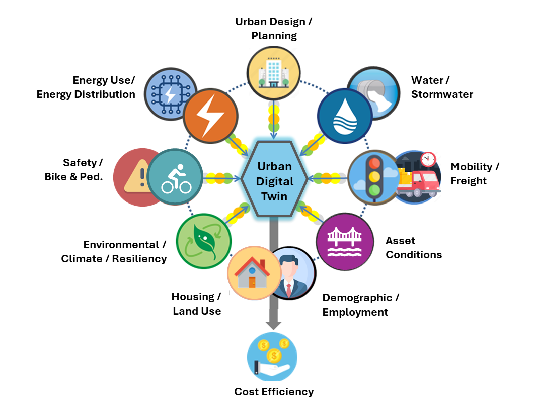
Urban Digital Twin

Improve decision-making, planning, and sustainability.

Cloud & Data Strategies

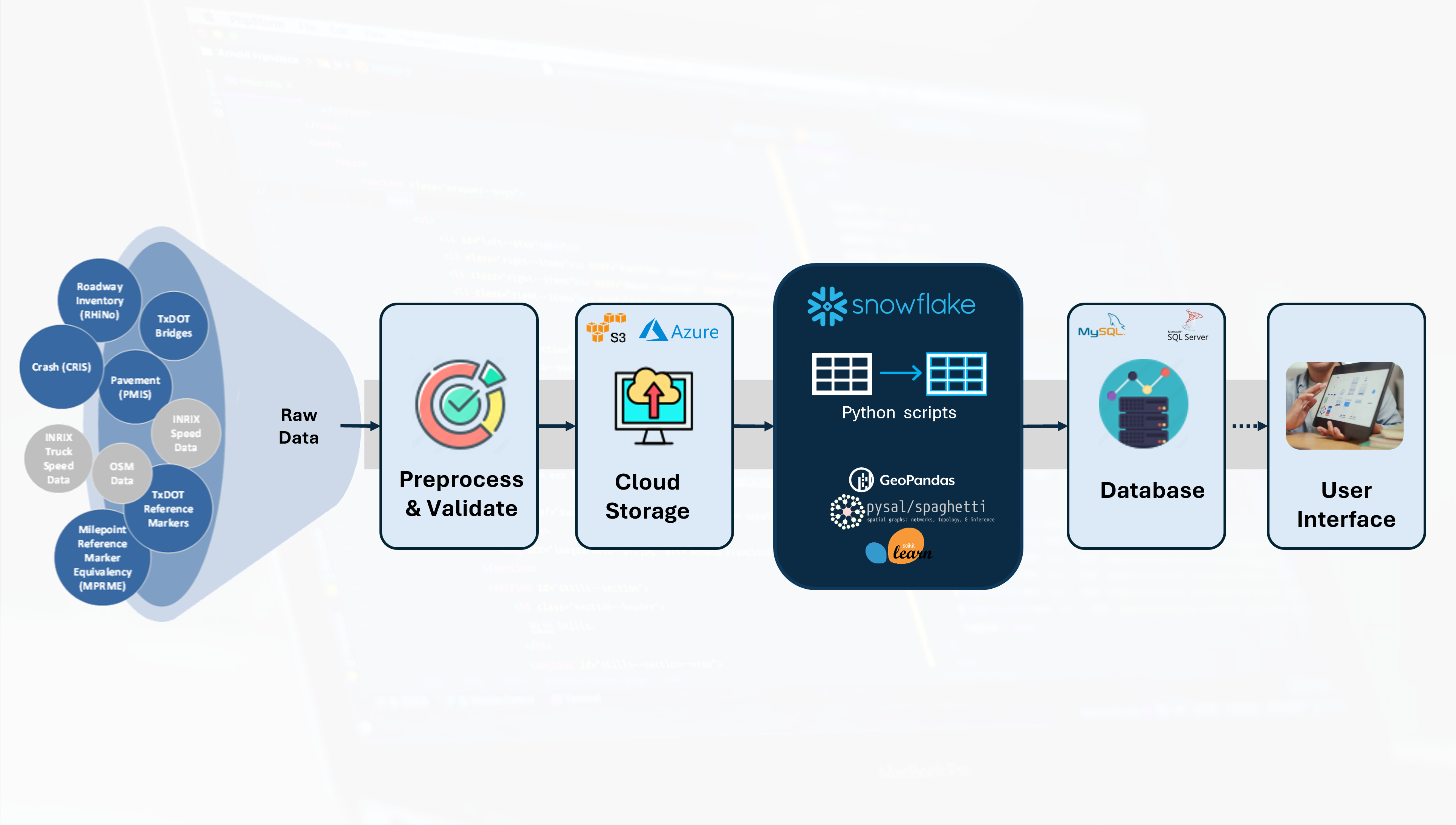
Big Data. Automation. Real-time.

Interactive Tools & Applications

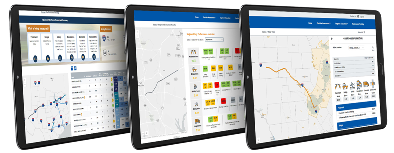
Robust. User-friendly. Transparent.

Geospatial Intelligence

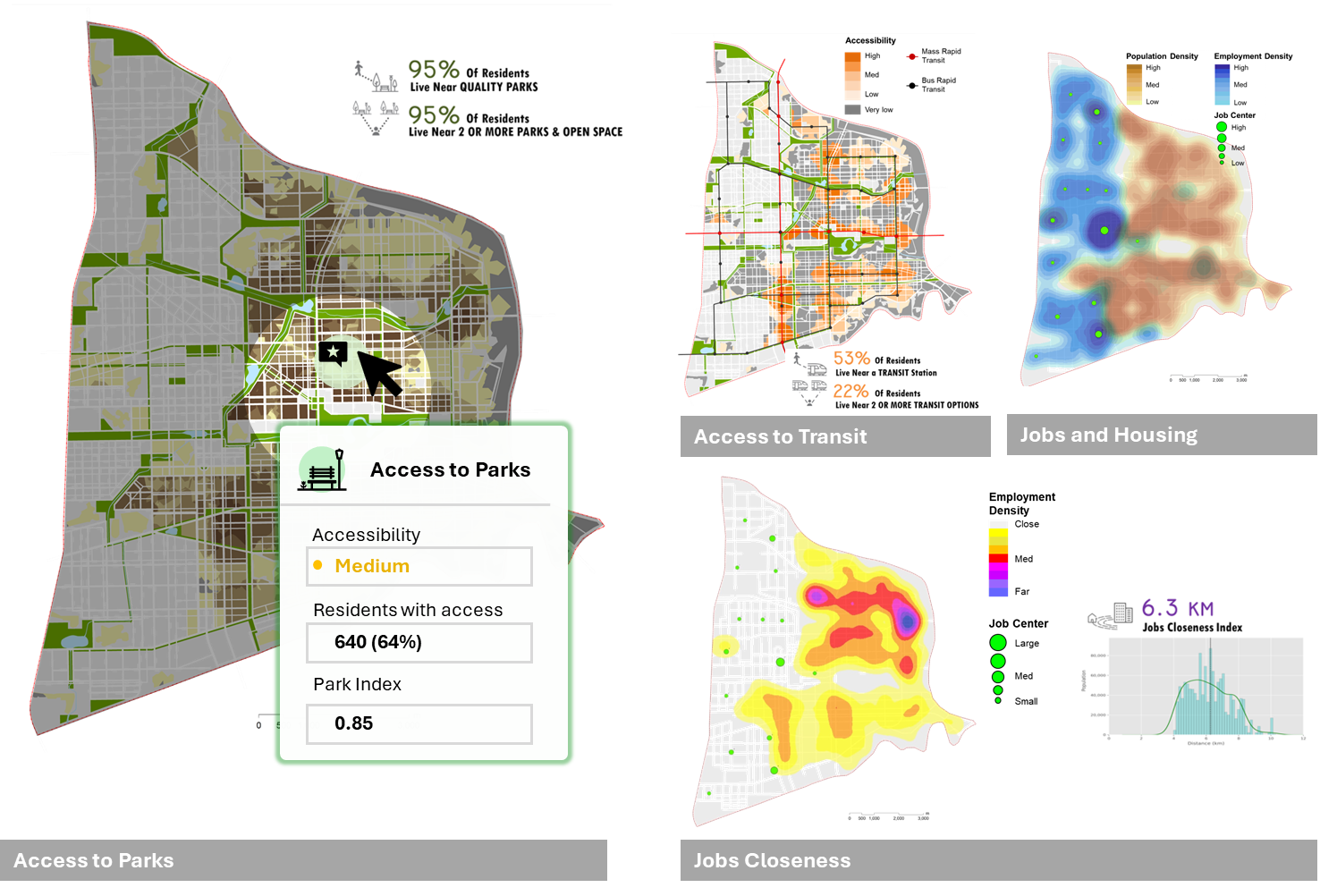
The intelligence of Where.

Urban Digital Twin / Simulation

Extensive Multidisciplinary Experience:

Over 15 years of multidisciplinary expertise within the urban built environment, specializing in sustainable urban form and integrated urban systems, including land use, transportation, energy, water, and related disciplines.

Advanced Urban Simulation Capabilities:

Proven track record of developing processes, tools, and workflows for urban simulation at multiple scales—ranging from detailed demographic and building-level analysis to broader scales such as parcels, neighborhoods, communities, regions, states, and national-level applications—employing a comprehensive, bottom-up approach.

Customized KPI Reporting:

Designed standardized and customized KPI reporting frameworks aligned with client-specific needs, featuring intuitive visualizations that enable easy interpretation and effective communication among diverse stakeholders.

View Examples
Urban Digital Twin / Simulation
Cloud & Data Strategies

Cloud & Data Strategies

Automate Data Workflows and Analytics:

Create automated data workflows and analytics solutions for your organization to increase efficiency, ensuring they are continuously updated with the latest, most accurate information.

Leverage Big Data and Cloud Technology:

Explore new opportunities by leveraging big data and cloud technologies, enhancing decision-making capabilities with enriched, multi-dimensional insights.

Break Data Governance Silos:

Overcome data governance silos through sustainable data strategies and tailored solutions that meet your organization's specific needs.

View Examples

Interactive Applications

User-Centric Interactive Tools:

Create highly interactive, user-friendly tools designed specifically to provide customized user experiences.

Agile End-to-End Solutions:

Offer agile, comprehensive end-to-end services that transform your visions and ideas into tangible, fully functional products.

Stakeholder Collaboration:

Facilitate collaboration by inviting both technical and non-technical stakeholders to engage directly with interactive applications, promoting inclusive participation and effective teamwork.

View Examples
Interactive Applications
Advanced GIS / Geospatial Intelligence

Advanced GIS / Geospatial Intelligence

Comprehensive GIS Solutions:

Deliver extensive GIS services, including mapping, spatial visualization, data management, spatial analytics, 3D GIS, parametric modeling, and custom GIS application development.

Web-based GIS Application Development:

Design, develop, and maintain robust web-based GIS services and applications, employing strong full-stack development expertise.

GIS Automation and Large-Scale Data Processing:

Automating GIS workflows and efficiently processing large datasets leveraging distributed computing technologies.

View Examples

Ready to learn more?