iNSIPP GIS Tool Dock for Navy Planners
Location: Navy Planning Enterprise-Worldwide
Client: Naval Facilities Engineering Command, Atlantic
Timeframe: 2013-2015
Firm: AECOM
Status: In Process
Role: Lead Developer of iNSIPP GIS Tooldock
Project Description
The US Navy Enterprise has real property assets in 10 regions around the world, occupying over 2.2 million acres of land, and it relies heavily on robust geospatial analysis for strategic planning of its installations through the Installation Development Plan (IDP) or master planning process. While planners may be trained in conducting such geospatial analysis through ArcGIS, the level of effort required to create IDPs and master plans can be challenging without a through understanding of geospatial workflows. Planners with a prior knowledge of ArcGIS may not be familiar with the complexity of data management protocols and mapping/data standards that demand a more efficient workflow.
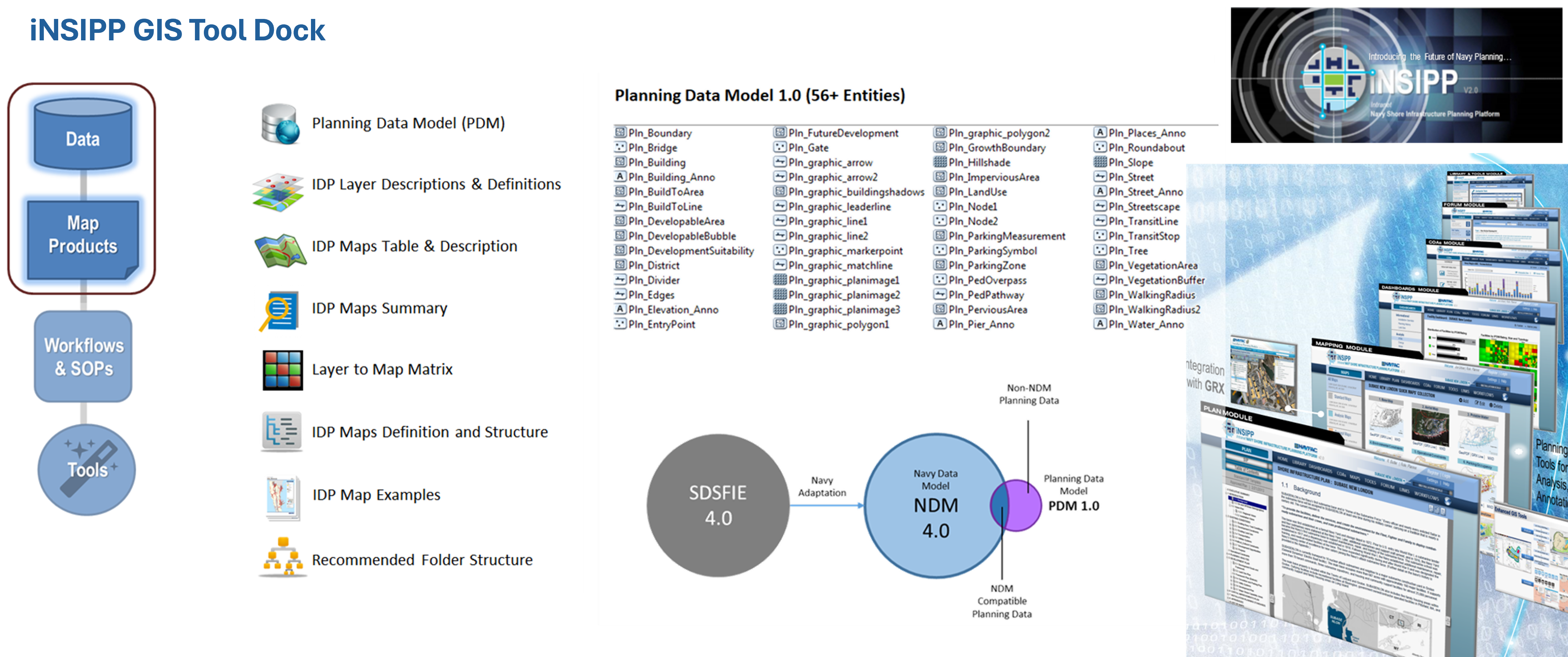
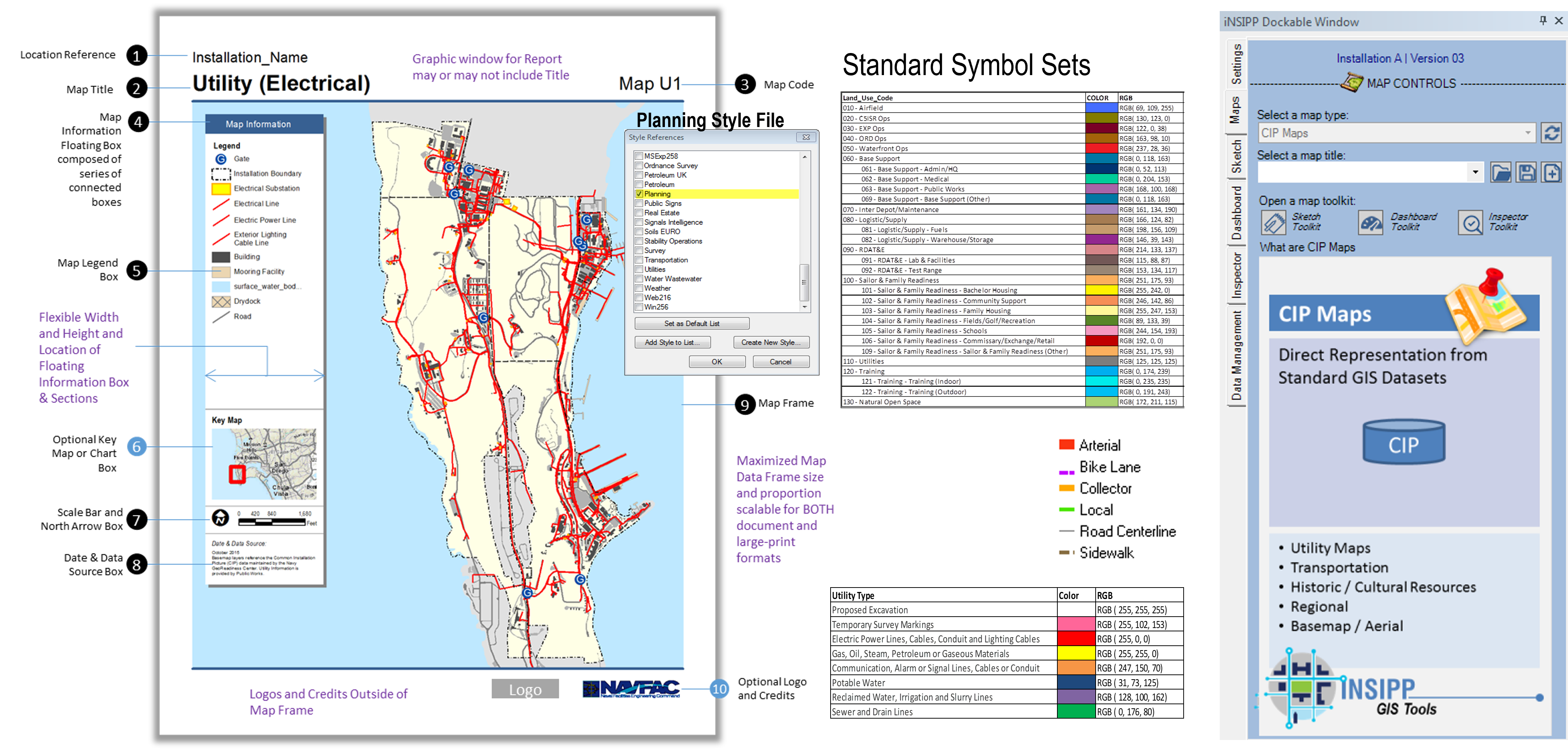
The iNSIPP portal is a powerful platform used by the Navy to facilitate its Shore Facilities Planning Process. This project developed iNSIPP GIS ToolDock training to enable planners to understand and leverage the functionalities of the portal. In addition an interactive document was developed as a reference guide for the iNSIPP GIS ToolDock. It guides planners in developing maps and managing geospatial data efficiently and consistently.